A Category 2 landfall on the Panhandle
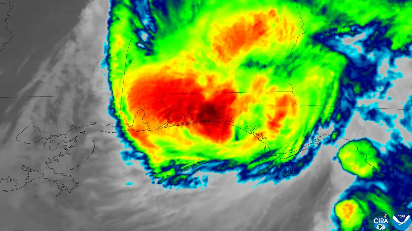
Hurricane Isaias has been downgraded to a post-tropical cyclone after making landfall near Destin, Florida, as a Category 2 hurricane, closing the chapter on a storm that ended one of the quietest Atlantic hurricane seasons on record. The National Hurricane Center (NHC) issued its final advisory on the storm early on Saturday morning, with winds collapsing to 35 mph as the system drifted north over Alabama — but forecasters warned that flash flooding, downed trees and power lines, and a lingering tornado threat would keep emergency crews busy across the US Southeast.
Isaias came ashore at about 8:30 p.m. Central Time on Friday with maximum sustained winds of 105 mph, a strong Category 2 on the Saffir-Simpson scale. In Pensacola, roughly 80 kilometres west of the landfall point, an AFP reporter watched howling winds tear roofs from homes and businesses, snap tree branches and knock out power. Hours later, the NHC reported that the storm had "very rapidly weakened" over Alabama and transitioned into a post-tropical cyclone, expected to track across the Tennessee and Ohio valleys before weakening below gale force.
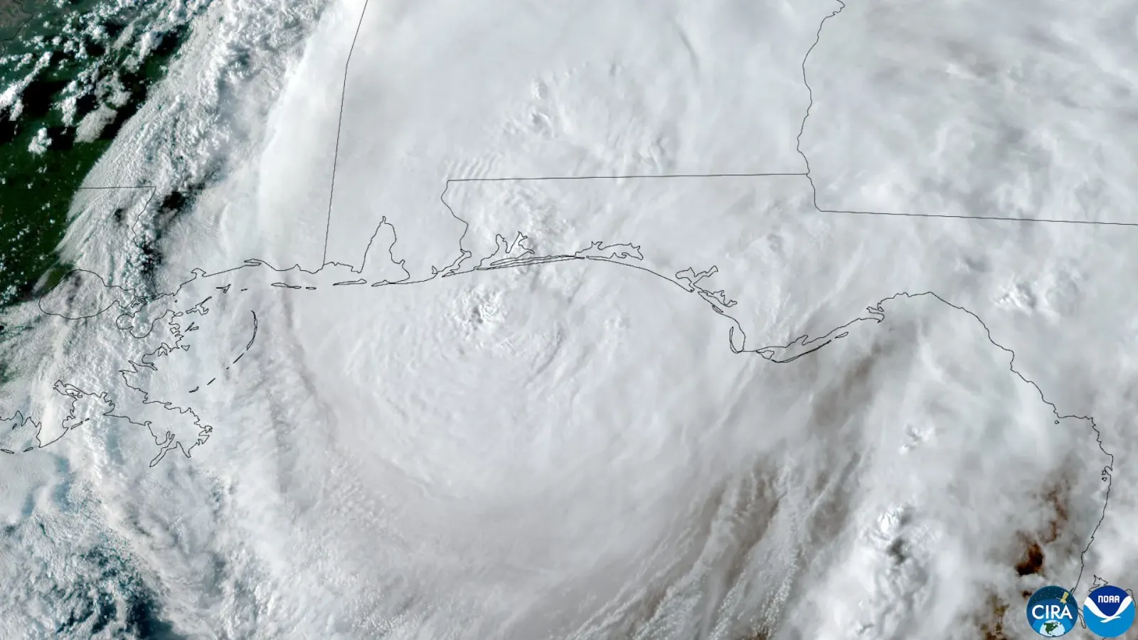 Satellite view of Hurricane Isaias approaching Florida's Gulf Coast on 8 October 2026
Credit: Satellite imagery: CSU/CIRA and NOAA via Wikimedia Commons (public domain)
A record-late first hurricane
What made Isaias remarkable was not only its landfall but its timing. The storm became the first hurricane of the 2026 Atlantic season on 7 October, tying a record set in 1905 for the latest-forming first hurricane of a season. In a typical year, the Atlantic produces about five hurricanes and two major hurricanes by early October; 2026 managed none at all until Isaias.
The reason, scientists say, was a powerful El Niño. The climate pattern warms the eastern Pacific and alters atmospheric circulation in ways that increase vertical wind shear across the Atlantic — a change in wind speed or direction with height that tilts a storm's structure and pulls it apart faster than it can organise. Five named storms formed during the 2026 season, but none lasted long enough or stayed organised enough to reach hurricane strength. NOAA's seasonal outlook had anticipated the lull, calling for below-normal activity with a 75 percent probability. El Niño, meanwhile, has supercharged the Pacific: it was the same phenomenon that helped Hurricane Simon intensify rapidly off Mexico's coast this weekend. For more on how oceans shape our climate, see Verity's science coverage, including the remarkable bluefin tuna comeback in Atlantic waters.
Hundreds of thousands without power
As Isaias came ashore, the outage-tracking firm PowerOutage.us reported more than 430,000 customers without power in Florida and nearly 297,000 in Alabama. The Florida Panhandle bore the brunt: as of the early hours of Saturday, Escambia County had 126,303 customers out — 73 percent of the county — while Okaloosa County reported 82,805 outages, Walton County 77,770 and Bay County 53,370. Florida Governor Ron DeSantis warned residents to assume they would lose power, telling a Friday news conference: "If you're in the panhandle, assume that you are going to lose power. Prepare that you are going to lose power."
Storm surge reached 5.6 feet at Panama City Beach, and the National Weather Service cautioned that swollen streams, standing water and fallen power lines would create hazards through Saturday morning. In Houston County, Alabama, emergency managers closed all county roads until further notice after the hurricane downed trees and power lines, and a flash flood warning remained in effect. The tornado threat was expected to continue across parts of the Florida Panhandle, Georgia and the Carolinas even as the storm weakened.
Evacuations and the federal response
Coastal communities moved quickly ahead of landfall. Florida ordered evacuations in Bay, Escambia, Okaloosa, Santa Rosa, Walton, Franklin and Gulf counties. In Alabama, Governor Kay Ivey issued a mandatory evacuation for non-residents, tourists and visitors in designated coastal zones — including Gulf Shores and Orange Beach in Baldwin County and Dauphin Island in Mobile County — while declaring a state of emergency for 40 counties and closing state offices across the southern part of the state. In a video message, Ivey said: "We often hear in emergency management: Hope for the best. Prepare for the worst. That is the approach we need with this particular storm system."
Homeland Security Secretary Markwayne Mullin said emergency declarations had been approved for Florida and Alabama, unlocking federal resources for the response. President Donald Trump told reporters outside the White House that the administration was watching the storm closely and that the situation was "under control" — a contrast with the president's more combative recent remarks, such as those Verity reported from San Diego.
Trump's cancelled Tuscaloosa trip
The storm also scrambled the president's weekend plans. Trump cancelled a planned trip to Tuscaloosa, Alabama, where he had intended to watch Saturday's top-ten college football showdown between No. 2 Georgia and No. 6 Alabama at Bryant-Denny Stadium. The projected storm track ran directly through Tuscaloosa, and the president said first responders needed to stay focused on the storm rather than on presidential security. He wrote on Truth Social that he would miss "that potentially unbelievable Game" but hoped it would go on despite the weather, promising to visit both teams at a later date. The game remained scheduled for a 7:30 p.m. Eastern kickoff, though ESPN moved its College GameDay broadcast indoors to Coleman Coliseum and the university restricted tailgating. Trump still planned to speak at a campaign rally in Clarksville, Tennessee, on Saturday ahead of the 3 November midterm elections — a contest where Republicans are already walking a tightrope, and where a slowing jobs market has added to the political stakes.
A triple tropical threat across North America
Isaias was only one-third of an extraordinary weekend of tropical activity. Off Mexico's Pacific coast, Hurricane Simon was rapidly intensifying as a Category 1 storm with 90 mph winds, forecast by the NHC to become a dangerous Category 4 hurricane as it neared the coast near Puerto Vallarta. A hurricane warning stretched from Punta San Telmo in Michoacán to Punta Mita in Nayarit, and Mexican authorities evacuated coastal communities in Jalisco amid warnings of life-threatening flooding and mudslides.
Meanwhile, Tropical Storm Rachel — once a hurricane — was moving toward the US-Mexico border, and its effects were already being felt in Southern California. High tides amplified by Rachel's swell overwhelmed streets in Newport Beach, where the city declared a local emergency on Friday after seawater poured across the Balboa Peninsula, flooding an estimated 15 to 20 blocks, stranding vehicles and damaging homes and businesses. Parts of Southern California were placed under a rare tropical storm watch.
What comes next
With all watches and warnings for Isaias dropped and the NHC's final advisory issued, the immediate focus shifts to recovery. Utility crews face a major restoration effort across the Panhandle, where some counties saw more than two-thirds of customers lose power. Alabama's emergency management agency warned that travel remained hazardous in the hardest-hit counties, and forecasters urged residents emerging from shelter to treat all downed power lines as live and to run generators only outdoors. The storm's remnants were expected to bring gusty winds and heavy rain well inland through the Tennessee and Ohio valleys, a reminder that even a weakened cyclone can carry danger far from the coast.
Read more of Verity's news coverage, or return to the homepage for the latest.