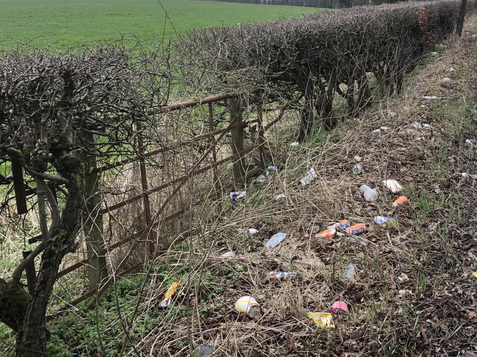
Every driver knows the sight. A layby with a burst bin bag. A verge scattered with bottles, cups and fast food wrappers, sitting there week after week because nobody with the power to clear it ever quite sees it. Robin Bennett saw it too, on the roads around Shropshire, and unlike most of us he decided to measure it. Bennett, who lives in Shrewsbury and runs a software company in Telford, has built an app that turns an ordinary car into a litter recording machine, and the results it has produced are now being used to press councils and road agencies on the state of the verges. The BBC's report on the project describes a tool its maker calls a litter dashcam, and it sits neatly at the point where a local frustration meets a very modern kind of evidence. More stories like this appear in our technology coverage.
How the litter dashcam works
The idea is deliberately simple. The phone or camera sits on the dashboard of a moving vehicle, facing out through the windscreen. Every 10 seconds it takes a photograph of the roadside passing by. Software using artificial intelligence then studies each image, identifies litter in the frame and grades how bad it is, so a stray can in the grass scores differently from a verge buried under dumped waste. Each report is pinned to a location and a stretch of road, which means the data builds into a map rather than a pile of disconnected complaints. Bennett's own company, Start Software, describes the same system on its blog after a demonstration drive with BBC Radio Shropshire along the A49 and A5 near Shrewsbury. According to that account, drivers mount a phone, open the web based app and select the AI dashcam mode, and the results upload automatically with the road name and the body responsible for maintaining it, whether that is a local authority or National Highways. There is no charge and nothing to download, and the team is keen for professional drivers, who cover the most miles, to take part through the Clean Up Britain app page.
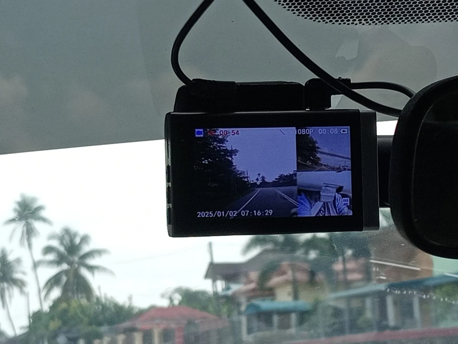 A small camera mounted inside a car windscreen, similar to the dashboard setup used by the litter app
Photo: Danielrayyan09, Wikimedia Commons, CC BY 4.0
The grading matters because litter arguments usually collapse into opinion. One person's untidy verge is another person's acceptable standard. A graded photograph, taken at a known place on a known date, is harder to wave away. The Start Software account says more than 250 of the Shropshire reports fall into the two worst grades, described as unacceptable under current legislation, and that the national database is growing by roughly 1,000 reports a week as more drivers join in.
What 28,000 reports add up to
The scale is what lifts this from a clever gadget to a genuine dataset. The app has logged more than 3,000 litter reports in Shropshire alone, and more than 28,000 across the country. Those are not cherry picked photographs of the single worst layby in the county. They are a rolling survey of ordinary roads, gathered at driving speed, in all weathers, by whoever happens to be passing. Bennett also has a view on where the problem concentrates, and it matches what the data shows. He says litter is worst near convenience stores, fast food outlets and motorway service stations, the places where food and drink are sold in packaging to people who are about to get into a car. It is a pattern councils have long suspected, but suspicion and a mapped evidence base are different things when budgets and clean up contracts are being argued over. Readers who follow environmental stories can find more in our science coverage.
Bennett is sharing the information with the campaign group Clean Up Britain, which campaigns for sustainable and effective answers to Britain's litter and fly tipping problem and has long argued that road agencies should be held to account for the state of the network. A shared map of hotspots gives that campaign something it has often lacked: current, local, photographic evidence, graded the same way everywhere, that can be put in front of the authority responsible for a specific stretch of road. It also gives clean up teams a way to aim their effort. Clearing a verge is slow and expensive work, and knowing which laybys and junctions are worst, and whether they improve or deteriorate after a clean, turns a thankless task into something that can be planned and checked.
Why councils find litter so hard to shift
None of this happens in a vacuum. Clearing litter from roadsides costs a great deal of money and puts workers in genuinely dangerous places, a few feet from fast traffic. National Highways, describing its own spring clean efforts, says litter takes a toll on the environment, poses a safety risk to road users, wildlife and the crews sent to collect it, and costs around a billion pounds a year to clean up across the country. The government has made the same point for years in blunter terms: a GOV.UK release on motorway litter put the cost of collecting a single bag of rubbish from a motorway at roughly the cost of fixing a pothole. Penalties are rising too. Keep Britain Tidy recently welcomed higher fines, with the maximum for fly tipping rising to 5,000 pounds and litter fines rising to as much as 750 pounds. Against that background, an app that costs almost nothing and runs on phones people already own looks like a cheap way to find out where the money needs to go. Local reaction and council responses run in our news coverage.
What Shropshire Council says, and what happens next
Shropshire Council, for its part, has not dismissed the project. Responding to the BBC, the council said it recognises the importance of a clean environment, which is the kind of statement councils make when a resident's initiative is too popular and too well evidenced to brush off. The interesting question now is practical. Will graded app data start appearing in council discussions about clean up schedules? Will the worst laybys near Shrewsbury get cleared sooner because a photograph and a grade exist, where a phone call might have been logged and forgotten? Bennett's hope, shared with Clean Up Britain, is that hotspot data forces a change in habits on both sides: drivers who stop treating the verge as a bin, and authorities who can no longer say they did not know. There is a longer read on the politics of local services on our politics pages, and the background to Verity's reporting is on the Verity homepage.
For now, the litter dashcam keeps doing the unglamorous thing that makes it useful. Every 10 seconds, another photograph. Another verge graded. Another pin on a map that is getting harder for anyone in charge of Britain's roads to ignore.